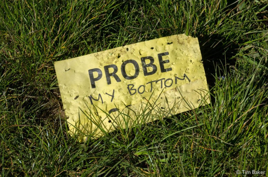
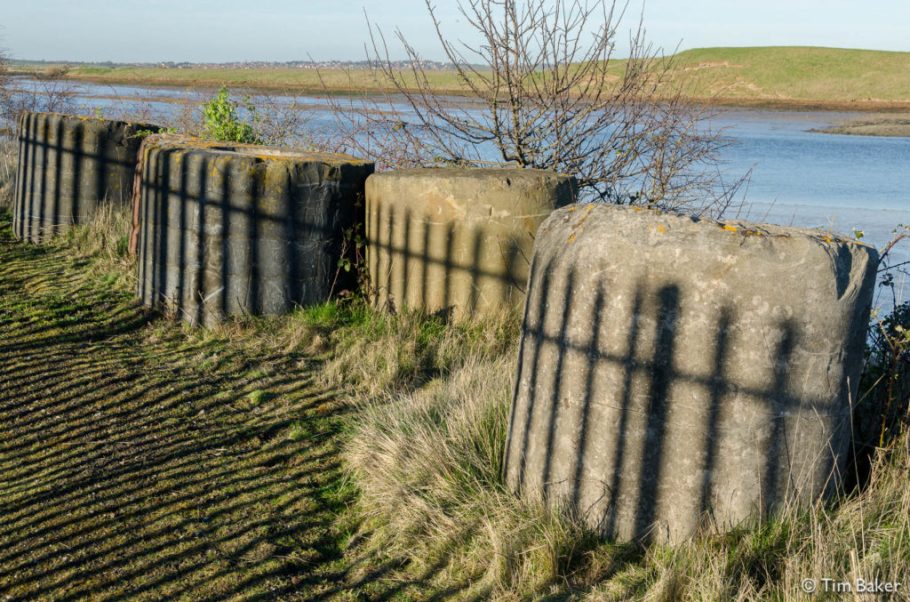
2014 Swale Sheppey Elmsley Eastchurch 20140519 DSC8922

Swale to Sheppey

This walk is all about the caged bird. Do they sing? Well the ones in the reserve make hell of a noise, whereas the ones in the clink probably don’t dare sing because it’s bad for your health – the cows will get you. All told a walk where I finally get onto the island of Sheppey, but run out of time and when dashing for the last train, then find out their roads are unwalkable.

And I know – long time no see. For various reasons, including illness and thus the walks last year ending in July, and other things I’ve not updated since last June (!). I have a few 2014 walks to post, then I’ll delve back into the archive, 2013 and beyond!

2014 Swale - Sheppey Elmsley Eastchurch_20140519__DSC8802

Here’s the new Sheppey bridge, there are two bridges to Sheppey, the local 1960’s Kingsferry Bridge that also carries the railway and the centre part lifts for shipping, and the big recent massive motorway bridge from 2006 which you can see above. Certainly the former is quieter so I took that since I’d missed the 334 and I didn’t fancy waiting…it seemed a long way across the bridge and along the busy road – even though it’s a local road, it’s not much quieter than the main motorway! You can see the abrupt exit of the path…crossing the road there you take your life in your hands! Maybe next time I’ll take the bus.

2014 Swale - Sheppey Elmsley Eastchurch_20140519__DSC8811

2014 Swale - Sheppey Elmsley Eastchurch_20140519__DSC8826
Mr Glove Feels How I Feel About The Traffic…

I wasn’t sure which way to head but I’d see the bird/nature reserve on the map and it was the only way along the coast. Seems like Elmsley has done some rebranding? Later turns out I was correct, it was RSPB but has now gone independent.

2014 Swale - Sheppey Elmsley Eastchurch_20140519__DSC8829

I followed the path past the farms, the CCTV signs (?) and the burnt out settee (??) and saw rabbits. Eventually I came to the track for the reserve, it’s signed but noticed there is a closing time, 8pm I think it was when I was there, but I suspect that’s for cars…no idea if there is access after that time. Turns out the other side is quite leaky, so I doubt you’d be shut in, but might be a long walk around or an ungainly shimmy over a fence or gate. Be warned to protect the birds from predators they have high gates here…

2014 Swale - Sheppey Elmsley Eastchurch_20140519__DSC8862
Not a high fence, but a wet one. Good for horse trials though?

2014 Swale - Sheppey Elmsley Eastchurch_20140519__DSC8852
‘Cheap cheap…guano going cheap…’ this bird wouldn’t leave me alone, noisy fucker.

I seemed to be the only one walking, there was a noisy bird stalking me above making a lot of noise even though I stuck to the path…must be used to drivers only. They were all driving around, single males, stopping and looking very furtive…it seemed more like a cruising area than a bird reserve? Very odd…I guess this is what twitchers ‘do’ – but like past experience of RSPB places it’s all motorism, car parks, not made for pedestrians or those arriving on public transport. Which I find really odd since you’d think they’d be more, well, ecological…given the horrors going on near John’s ‘Villa’ in Burnham-on-Crouch (more of that on a later walk) in the name of creating a bird reserve – actually just finding a dumping place for CrossRail rubble – there’s a lot of strange not-that-ecological bird-brained stuff going on. It does seem the birds matter most, but the means aren’t considered? It’s not like cars are particularly friendly to birds anyway.

2014 Swale - Sheppey Elmsley Eastchurch_20140519__DSC8875

2014 Swale - Sheppey Elmsley Eastchurch_20140519__DSC8868

Trying to avoid the bird who wants to re-enact Hitchcock for some reason (swearing at it didn’t help, I just hurried on along the road), this place is waterlands, with grazing cows and distant factories, which makes for an odd juxtaposition. Don’t get to chummy with the cows – John hates cows, he’s scared of them. I’m not, but these lot seemed to gang up on me, and I had to make a sharp exit. Maybe they are camera shy? Or represented by Getty?

2014 Swale - Sheppey Elmsley Eastchurch_20140519__DSC8880

2014 Swale - Sheppey Elmsley Eastchurch_20140519__DSC8886
They’re coming for you, Barbara, They want to talk to you about the steaks you’ve been eating…

As you get closer to the coast you find rather overgrown sea walls, with annoying signs telling you not to look over them because it will ‘disturb the birds’ – it seems the birds are already disturbed, proper mental in fact. So you trudge on for a bit, but rebel I am I later popped up to have a look…path was so overgrown it was unpassable. I just got so bored of seeing a green bank though, I had to go look. I didn’t see any birds, actually. Or much of anything…

2014 Swale - Sheppey Elmsley Eastchurch_20140519__DSC8893

2014 Swale - Sheppey Elmsley Eastchurch_20140519__DSC8914

Ahh! At last a bird. Err…a dead one. I doubt in a nature reserve crows and ravens get the same ‘respect’ (i.e. shot or ringed necks) they do in farms. I wonder how this one died – car strike? Rather pretty house here – barn I guess….there isn’t many distinguishing features in Elmsley apart from the hides, the mad birds, the cows and the odd ruin/barn. This one you can see miles away, I have loads of pictures of it.

2014 Swale - Sheppey Elmsley Eastchurch_20140519__DSC8930

2014 Swale - Sheppey Elmsley Eastchurch_20140519__DSC8926

Rather worrying is this sign about a sewerage pipe leaking. Next to a nature reserve? I could rant all week about the various Water companies, they always go on about how they own so much land and thus protect wildlife, but quite often end up polluting it, wrecking it, creating massive ugly canals and earthworks, and a lot of signs telling you that instant death will befall you if you even breathe on their equipment. It seems their very M.O. is at odds at actually preserving nature, quite often unless they unusually leave it alone in the case of some ex-reservoirs. But then someone usually has the bright idea of filling the lake with grotty yachties, tourists, birdwatchers and their motor cars, or build over it with houses.

2014 Swale - Sheppey Elmsley Eastchurch_20140519__DSC8932

Still that means this is somewhere that has some right of way. I’ve left the reserve via their massive gate, and now on a track. It’s marked on the map…no signs telling me it’s private, so I trudge on. It’s getting a bit late and I need to get back to Queensborough or Sheerness station – planning for Queensborough via Eastchurch but there are some surprises in store. My how the caged bird sings…

2014 Swale - Sheppey Elmsley Eastchurch_20140519__DSC8939

2014 Swale - Sheppey Elmsley Eastchurch_20140519__DSC8950

Loads of canals and windpower here, there’s a windpower farm ahead. The map seems strangely fuzzy and incomplete, but I had heard mention of a prison…

2014 Swale - Sheppey Elmsley Eastchurch_20140519__DSC8952

The loneliest bus stop, next to Her Majesty’s Pleasure. I suddenly come out of the track into a prison! I pause, wondering if I should be here? No signs, and examining the bus stop reveals that normal buses do stop here, so there must be some access, right?

2014 Swale - Sheppey Elmsley Eastchurch_20140519__DSC8954
Err…I wasn’t planning to investigate further, honest!

2014 Swale - Sheppey Elmsley Eastchurch_20140519__DSC8957

The rabbits LOVE the green grass between wire and walls, I guess it’s a no-go zone and they are left alone. Maybe they are trained to eat escaping prisoners? Rabbit guards.

2014 Swale - Sheppey Elmsley Eastchurch_20140519__DSC8961

After wandering though with camera, doing my confident ‘I’m supposed to be here, don’t bother me’ routine I find this sign at the entrance. Oops. Why no sign on the other end? Do people never walk from the Nature Reserve or farm? There was a sign also saying not to take pictures….err…too late. Partly why I didn’t post this at the time, I was a bit wary. But this was a genuine mistake, and I wandered past many staff and wasn’t accosted. But headphones on, camera in hand and marching on, I guess I looked determined, or something?

I then try and walk along the road from Eastchurch to Queensborough. It starts off OK, but the pavement runs out. By now it seems like it’s local rush hour, and many cars are whizzing by at 40-60 miles an hour. It’s scary, and unwalkable. Thing is, there doesn’t seem to be any other paths, along the coast or here connecting Queensborough with this part of the island…it seems to be one of those situations where you have to ride the bus. But I needed to get to the train so I couldn’t wait for the cars to pass, I had to march on. Not fun.

I looked so scared that a passing police car stopped…he asked if I wanted help, I said yes because there wasn’t any pavements. So I got a lift to the station! This meant I actually caught the train, and got home in good time. One of the few times I’ve been relieved to see a copper.

So next time I’m going to get the bus from Sheerness or Queensborough past Eastchurch, and only walk what I can and take the bus back – or do it all by bus and just walk from Sheerness to Swale, on the other side. That looks doable. My rules are to walk around the island, but looks like unless I wade along the mud for 20 miles and probably find a few more prisons, this isn’t possible.

Can’t We Get Rid Of The Pointless Stats?

Food
1 1/2 litre of water – I do take too much sometimes!
Wheat free rolls? I have memory of something like that…such a long time though!
A few M&Ms and jelly snakes for instant energy.

Music

Fleetwood Mac – Fleetwood Mac, Mystery to Me, Future Games, Heroes Are Hard to Find, Penguin and Bare Trees – a whole lot of Bob Welch era early 70’s Mac! 9/10
When In Rome – The Promise 12″ – 6/10

2014 Reading to Goring_20140514__DSC8506

Reading to Goring

Otherwise known as Path Wars: Attack of the Cyclists, this was a walk back in May continuing the walk from Reading to Goring & Streatley. Original plan was just to go to Pangbourne or Tilehurst if the weather changed or I had to abandon, but actually the weather was fine and I made good progress. I knew that after Goring it was a bit fun to work out the next exit, so that was another walk.

2014 Reading to Goring_20140514__DSC8493

First up was the Victorian drinking fountain on the Thames Promenade car park. It had seen better days, but an amazing survivor from days when public drinking water was a health issue. It was erected in the 1890’s to commemorate Frank Attwells, Mayor of Reading 1891-2, in fact he died in office – I assume put up by his wife Sarah, who died in 1905 and was also commemorated. I wish modern fountains were as grand. As usual, it had become an impromptu dumping area for rubbish 🙁

2014 Reading to Goring_20140514__DSC8492

Walking onwards past the very pitchurskew canal boats and very posh houses on the other side of the river, and the swans, ducks and geese en masse. I was struck by the view across the fields of what looks like a disused Leisure Centre, or at least a very beat up one. In it’s sorry state, it reminded me of a concentration camp, a sort of Ghetto of Fun. Those places creep me out, in fact, the enforced jollity factory nature makes me think of people or leisure being processed, like a sort of meat. It’s one of my favourites, hence why it’s the featured image at the top.

Also being late afternoon on a sunny day there were many people leisuring themselves on the river, along the river playing table tennis in their gardens or just enjoying the sunshine. Hate to think how many millions those houses are worth. I seem to be making a habit of taking pictures of canoeists and rowers recently, and this was not an exception:

2014 Reading to Goring_20140514__DSC8510

Cuteness to the max were the baby ducklings and baby swans, a contrast to the dark thoughts about factory fun palaces. But it was a nice stroll along the river, and the Promenade is quite wide and thus you don’t mind the cyclists whizzing by. This was an all too brief respite, sadly.

2014 Reading to Goring_20140514__DSC8515

The promenade narrows into a small path along fields. You’d think this would mean the cyclists would slow down, but not at all. The path is at some points barely wide enough for two people to walk side by side, at some points only big enough for one person. Definitely NOT a cycle track. I looked around for signs, but apart from a later No Motorbike sign I saw none until later…but surely cyclists had more sense than to bomb down a single track path en masse?

2014 Reading to Goring_20140514__DSC8533

You can see from the picture how being passed by cycles at speed walking on the path might be not only intimidating, but dangerous. Many cycles passed me, quite a few at speed helmed by Lycrablokes with expensive mountain bikes. This is a cycling rat run! But I mean it’s not like there is anything suggesting that you shouldn’t ride down here or anything…

2014 Reading to Goring_20140514__DSC8541

…oh.

There are quite a few gates after this, but it seems that the cyclists don’t take the hint that like commuters and towpaths, maybe bombing down small paths isn’t that pedestrian friendly, nor encouraged (otherwise why are the gates there to make cyclists dismount?). Apparently according to one I accosted, 30+ bikers use this route. It’s the Thames Path, which usually doesn’t allow bicycles, but the bloke was using the classic ‘there’s no sign telling me not to’ argument which is always the response of someone who isn’t thinking, or usually doing something they know is anti-social. I pointed out that there are many things that don’t have signs, like not killing people or not being a complete dick…doesn’t mean you’re allowed to. Sadly I think Thatcher’s Children and beyond have the idea that they are entitled to do as they please as long as the Nannystate has not explicitly and visibly forbidden it. This is why we have so many silly redundant signs for people like this, like ‘Danger! Kettle Is Hot!’ and ‘Warning! River Contains Mud and Deep Water’ – because if there isn’t a sign they bleat as they sink below the muddy water. Let these (not) grown-up children drown, I say. It’s Darwin in action.

2014 Reading to Goring_20140514__DSC8578

Happier thoughts, or trying to have them as you come along side the brick railway embankment, lots of old fading graffiti, CND signs, skulls, that sort of thing. You try and ignore the bikers bombing past within an inch of your nose – even though there are a few families with pushchairs, I hate to think what happened when they screeched around the corner and there wasn’t space for either bike or chair. It’s quite dark here, with trees, a bit cold actually even with the sunshine. But you happily stroll on until the path suddenly and inexplicably runs out. Name and shame time here: ROEBUCK FERRY COTTAGE – COME ON DOWN!

2014 Reading to Goring_20140514__DSC8584
Here is the gate. I pissed on it to show my ‘appreciation’

Yes it’s one of the destroyed ferries, I guess the path would have switched to the other side at some point, but not any more. So you have a happy traipse along a massive road for several miles ahead of you. Before heading up to the massively and impressively over-engineered bridge, you see this strange pub sign. Maybe the Cottage used to be a Hotel? Maybe you could get through there? No sign of the Hotel, and give the sign’s repair, looks like it hasn’t been running for some time?

Not shown is the ‘Welcome to Reading’ sign behind it, tempted to add sarkily ‘Enjoy our crazy cyclists’. It’s a good thing those cyclists were quite often doing some sort of sprint back up the path back where I came from, because on the bridge and beyond they weren’t that welcome. The bridge not having ramps or any concession to cyclists again suggests they weren’t in the right, either.

2014 Reading to Goring_20140514__DSC8587

Over the railway bridge and up onto the quite busy road, you after a short while come to another path, through a private wood. This makes it very clear that there are no cyclists allowed. Yippee! Problem is, the wood is far too short, and you get dumped into a very strange Surrey-like housing cul-de-sac. Not unpleasant, but a long way from the river (now the other side of a railway too) and not exactly green nor pleasant. This is the delights of Purley, and after a mile or two of it’s never-ending middle class estates, you’ll be tired of it. It’s one hell of a detour so some people can play ping pong in their garden!

There is another classic Thames Path misdirection trick here though at the junction of St Mary’s Avenue where it says ‘Thames Path to the Lock’. This skirts along the edge of the housing estate but doesn’t go near the river for quite some time like it might suggest. Ignore that and head down the avenue towards St Mary’s church if you want a much nicer walk along the river. This must be some weird way of appeasing the locals that they get their path in peace without pesky walkers? Very odd, and not the first time I’ve seen signs directing you AWAY from the actual/nicest path. I’d always prefer to walk along the river, rather than up a small road across an estate, any day.

2014 Reading to Goring_20140514__DSC8607

So if you walk past the church along Waterside Drive to Brading Way you’ll see a path off Chesnut Drive to the river. This is where you’ll find a Path Ends 100m sign back where you came from – the exciting end of that path is pictured above. The inhabitants of what seems to be 26 River Gardens, Purley are building a really ugly building, as well as blocking off the path for everyone. I suggest if they want to sell you that building tell them where to go, since not only does it look fucking awful, it follows that if they treat us mild walking types badly they probably then have no scruples in other dealings too (Hello Google! Hello Estate Agents! This is a lesson in name and shame, allow public rights of way or I’ll call you out and lower your property prices :-P)

2014 Reading to Goring_20140514__DSC8609

A much nicer sign reminds you this is Wind in the Willows land, Kenneth Grahame not only grew up in Cookham – we’ll visit there in an earlier walk – he died at Pangbourne near here. By which I mean he lived there, it wasn’t some accident or suicide tourism (Come To Pangbourne And Die! Oh You’ll Laugh!’). As a result you do see a lot of Ratty tat, but this one on a barge is really nice.

The River Gardens looks severely private, and tries to give that ‘you shouldn’t be here air’ but actually it isn’t, as you will find the gate to the a well hidden, (possibly intentionally) footpath sign. This part of the walk is beautiful, the best part, and you can see why the locals might want to keep this secret.

2014 Reading to Goring_20140514__DSC8625

COOOOWS! The river meadow walk along to Mapledurham Lock is very peaceful, and a nice respite from all that tarmac and concrete. At the lock you’ll join the path from St Mary’s Avenue, and be grateful you didn’t go that way. I promise you.

2014 Reading to Goring_20140514__DSC8638
The lock has a nice looking cafe but it was closed. ‘OPEN FOR ICES DRINKS CRISPS…ALSO PLANTS’ – yum! Plants!

Onward past the lock and again, some amazingly scenery across the river – towards Goring Heath looks like it has some landscaping – remains of gardens? But on your side there is also Much Pichtureskew. Wow. Such lovely. So photo.

2014 Reading to Goring_20140514__DSC8643

2014 Reading to Goring_20140514__DSC8648

Quite a few boats along the river, the high bank makes this look like it’s actually sailing on grass, not water.

2014 Reading to Goring_20140514__DSC8667

I’d love to live on this boat – old school and an amazing setting.

2014 Reading to Goring_20140514__DSC8681

You can see what I meant about landscaped, those hills aren’t naturally like that.

2014 Reading to Goring_20140514__DSC8683

No idea what birdy this is. Grebe? Crested grebe? Big bird? Blue tit? Red Metal Headbanger Bird? IHNI. I usually get annoyed at those signs everywhere which you hope to have interesting local info, and usually all have the same canned info that this place is the place in the world you’ll find a Lesser Great Crested Booby Fartywhoopbird and a really rare Blue Buttocked Ant, or something. I’m sure someone loves those, but I’d rather not know what type of grass is so special it grows upside down, or whatever it is. Give me historical info! Walking info! A Map? Just something that isn’t just ganked from an Osborne House Nature Book?

2014 Reading to Goring_20140514__DSC8709

Proud of the timing of this picture…was already aiming and the crow just photobombed me. I have two shots, with and without. This is my favourite. Nothing else to report here, really. PICCIES!

2014 Reading to Goring_20140514__DSC8717

2014 Reading to Goring_20140514__DSC8720

It was around here the insects started to get a bit much, and I saw more rowing & canoeing. There seems to be several canoeing schools here, and one especially at Pangbourne – I guess that’s the embarassingly titled ‘Adventure Dolphin’ – and Goring. And onto Pangbourne Meadow – with sadly the return of the bicyclistes. The path diverts somewhat at Pangbourne, as they haven’t finished replacing the Whitchurch-on-Thames tollbridge. Yes they still have one of those, no idea how they kept their sticky hands onto it…but it’s all a Big Hot Industrial Mess at the moment.

You can still get over the river on a footbridge though. I was 50/50 whether to stay and find a nice pub, but it was only 8pm and I could see Goring & Streatley was only a few miles away. I watched a canoeist do endless eskimo rolls from the bridge and shuddered – I once did one of those PGL/summer camp things, but never could do canoeing because I couldn’t swim, so got left alone on the shore for hours. Very boring, but I hate being underwater…truth was I was dreading doing those rolls anyway. What happens if you can’t get back up?

2014 Reading to Goring_20140514__DSC8753
St Mary The Virgin, rather than St Mary the Complete Whore, St Mary The Scarlet Hussy, St Mary Does Oral Count? and St Mary Will Shag Anyone For Chips, I guess?

This is where it gets rather odd, not sure if it was the bridge or lateness but I got a bit lost around the mill – the path to the church is well hidden. Then through the very pretty churchyard, past the Tudor houses (ooh nice pub! Boo! Now having second thoughts about that eating/drinking thing…) and onward past about 10,000 galleries. It seems Whitchurch exists for small galleries and tat shops. Well it certainly doesn’t exist for footpaths, pavements or easy rights of way, that’s for sure.

When you find Hartslock Bridleway, apart from the severe looking PRIVATE CARRIAGEWAY type signs which are slightly off-putting, it’s very much a direct mostly un-rivered (is that a verb? Is now) slog to Goring. It gets quite steep in places, and sadly I couldn’t get a good shot of the sunset. On the upside, I didn’t get a shot of the sunset. So it works out really (I know, I have to take them even though I never post them, because it’s JUST SO CHEESY).

2014 Reading to Goring_20140514__DSC8797

One of the interesting things is the sudden arrival of pillboxes. No, not the drug sort, the military sort, out of the blue. You’d not think sleepy Pangbourne or Goring as being the frontline of the Second World War, but on my next walk I spotted quite a few RAF bases, such as Abingdon and Benson – and a few that the Yanks won’t give up. So I guess they were worried about crack German Barge Commandos, slowly making their way up the river in Cammo Narrowboats, pretending to be tourists when all tourism had stopped…no, that wouldn’t work. The mind does boggle, but then again I guess small boats could make their way up river, so hence the pillboxes along it. There were many more on my next walk…this deserted one looked rather poetic in the forest. I didn’t go inside…far too late, dark and I hate those kinds of spaces!

2014 Reading to Goring_20140514__DSC8800

As it was nearing the elections, I found it funny someone had thrown blue paint on the UKIP sign in one of the fields. Really, if you were voting UKIP you should not only be ashamed, you shouldn’t really be advertising it. I ended up at Goring & Streatley station just in time for the train, was a bit of a scamper but made it, so went back to Reading. I went to get some coffee, and had an interesting conversation with the Reading University student serving me. I mentioned the cyclists and she said she was from Oxford and cycled everywhere there, but in Reading the traffic was too much, and she gave up after a week. She wondered where the cyclists were…suddenly it made sense! The cyclists were using the paths as rat runs to avoid the cars…so much for Reading the new silicon city!

As I tweeted back then, it did seem an own goal though, the problem with doing that is not only does it annoy the likes of me, it also means motorists don’t get used to cyclists. The same argument over riding pavements I had with Critical Mass people applies here – that separation/avoiding traffic doesn’t work, it means the drivers get away with bad habits and never learn, and the pedestrians get annoyed with the bikes in their space. I walk on footpaths to avoid traffic, the commuter rat-run that goes through where I live 4-7pm, the idea is to get away from people and traffic. This completely fails if then the traffic then comes zipping by at high volume?

Return of the Pointless Stats!

Food

A few M&Ms – I think I ran out
1 litre of water
1 Cappuccino

Music

Disco – loads of 70’s & 80’s Disco and No Wave such as
Disco Not Disco 1 & 2 8/10
Ben Liebrand – Grand 12 Inches 1 & 2 10/10
Sage Francis – Sick of Li(f)e mixtape especially Origin To Descent and Years Demo – 9/10
Random Bootie mashups – pretty good, 7/10

Naughty Bicycles photographed for abandoned name & shame FB group or blog called ‘2 Wheels Bad’:
5

Canoeists photographed (no shame):

21 (!)

2014 Bourne End to Shiplake_20140318__DSC7744

Land Grab

crossposted from radioclash.com, it seemed pertinent here also – and yes I have more posts lined up, as it’s been better weather I’ve been walking or doing other stuff – rather than spending hours indoors selecting photographs and writing!

While most of the country seems to be worried that Uragoing Home from the World Cup, I’m more concerned about the Infrastructure Bill and the land grab going on. There are two things: like the horror of what happened to Royal Mail, the Land Registry is being privatised, and this new Bill allows building on brownfield sites and other sites without regard for planning, rights of way, or any previous restriction. Yes, just like in Hitchhiker’s Guide To The Galaxy they can turn up on your local common land, park or disused site with a yellow bulldozer and start a new bypass. Unlike Hitchhiker’s they don’t even have to bother with the filing cabinet with Beward of the Leopard on it anymore. This is what the new bill proposes, to transfer public land to the new body and then make it available for new houses, roads or even nuclear reactors and fracking without those pesky activists and locals getting in the way. If you thought selling off the forests was bad, this seems much worse. If you like walking, cycling, or just not having roads driven through your neighbourhood without consultation (and houses without any new schools, better roads or infrastructure to support them) then you need to stop this Bill and the flogging off of the Land Registry.

So what can you do? Well I wrote to my MP via WriteToThem as you can see below, but I also signed two petitions – one about the Land Registry sale (now at over 100k signed), and another about the Infrastructure Bill (22k strong!). Remember the expenses outrage? Remember trying to sell off the forests? We won those, so can win this. That is unless everyone is more interested in a football game rather than getting a motorway at the end of their street.

Dear Glenda Jackson,

Thanks for your previous letters, I hope you are well.

I’m writing today about the proposed Infrastructure Bill which had second reading on Wednesday, and the privatisation of the Land Registry. I’m sure you’re concerned like myself at the privatisation of services (like sadly happened to the Royal Mail and the giveaway that happened there) but the new bill contains provisions to easily sell and develop brownfield and other sites…this seems a charter to build houses, roads on common land, parks, and other green sites – ignoring rights of way, which as a walker I find essential and much attacked or ignored by the current Government and councils, but also the agreement of the community, local planning, any restriction seems to go out of the window.

I agree more houses need to be built, but there are enough abandoned factory sites and areas that aren’t needed for this, leaving the Bill so vague means it could be another Enclosure land grab, on common land sites. I still remember Twyford Down, still remember M11 link road protest, and many more that had a lot of local support. And of course fracking would be easily done via these new rules.

And of course motorism, do we really need more roads? Especially ones that ride roughshod over the local community, planning and local wishes, taking the rights of way away, so it’s a self-fulfilling prophecy of forcing people onto the roads, or at least walking along them…quite often all of these motorway/road developments ignore what cyclists and pedestrians have to do to avoid the multi-lane commuter highways – paths end without bridges or tunnels, alternate paths are not created, alternatives do not exist. This new Bill seems ideal to exacerbate this trend, of houses built without proper support from the community which has to bear the brunt of the influx of people and cars, of roads that are built without caring how the locals might cross it, but of course the construction companies and road lobby gets rich – and one guess who they donate heavily to.

Of course The Queen and aristocracy are exempt, so it’s very much an issue of Let Them Eat Roads/Houses on our land, and again reminds me of various land grabs over the centuries. This Bill and the shift of the Land Registry must be stopped, otherwise I fear that the idea of common land and public rights of way will become history.

Yours sincerely,

Tim B

Walking washout and walking gear

It seems the easiest way of making nearly a whole month a complete washout due to rain is to declare ‘National Walking Month’ (drought-stricken areas take note!). I’ve only had one walk in the month of May, the weather has been so bad, or the few good days I was ill or busy. Thanks Living Streets! :-/

Sadly the washout also spread to the blog, for which there isn’t much excuse apart from just as I was preparing one post, the weather cleared and I went walking – only to go crap again. I hope this means the spring is all raining and and next month is AMAZING (partly because I iz going to Glastonbury for the first time). Busy with other projects like the podcast and some mixes, and some server woes needing fixing took me away from walking & blogging too.

Anyway when the weather is crap like this, even in urban areas walking can be a bit fun. I said in the previous post how you don’t need anything special for walking – and I stick to that, you just have to put one foot in front of the other and keep doing that for as long as you want. But, if your footwear is either of the genteel work/dress shoe or even traditional walking boot you’re going to slip if it’s persisting it down….I learnt this the hard way walking on the cliffs near Garennin in Lewis with some CAT boots and an army pack on my back. It had been raining heavily the night before, and I hit some wet grass and over I went…

Since then, grip has been a priority. So enter the cross-trainer or approach shoe, the same but different names depending who you ask. The idea is for the crazy people who go running across clifftops and along mountain paths , or a lighter sort of shoe for the mountaineer so he or she doesn’t have to walk to the mountain approach in big heavy mountain boots.

They are waterproof (I’ve waded through the sea in them, through puddles and muddy fields which are more like swimming pools), light and breathable, with soft soles for grip.  I usually wear wanky North Face Hedgehog XCR III GTX, I’m on my 3rd pair. They are not only are not cheap, they version I liked aren’t made anymore, and about the new IVs – as a friend says, sequels are so disappointing aren’t they? Don’t look as nice, they’re still silly price (although shop around, I bought one of the last pairs of the old sort in garish red for the future) and according to reviews, cheaper made than the old ones.

18318103_xxl

So given that my current ones are wearing down (they only last a year at best if you wear them all the time) I decided to investigate cheaper footwear for general use, but with a similar grip, waterproof because even in the city puddles are deep, and breathable. Via the recommendation to a friend of a cheaper but not waterproof pair, I came to Karrimor Mount Low shoes. And at £20 (shop around, Navy is cheapest oddly, but Amazon & Ebay have good deals), rather than £100+ they’re Nice Price, and again I think I’m buying the older ones here, it seems a similar situation to the North Face shoes, cut price. But if you stick to the style I bought (see the picture) and/or buy like I did via Field and Trek which is actually a cheaper outlet of Sports Direct seemingly, then you’ll be OK.

I’ve been wearing them for a few weeks. So are they waterproof? (being ‘Weathertite’ and not the tried-and-tested Goretex). Well even the king of Cross Trainers the North Face Hedgehogs have let me down once (wet tall grass, it’s the worst test for any waterproof, more than standing in a puddle seemingly) but I’ve been wearing them in rainy London, even wading through a few deep puddles For Science. Yes for Science! And this blog! And they’ve been fine, so not sure what happened with some of the Amazon reviews . They are thicker and chubbier than the Hedgehogs, seem to be more ‘support’, but surprisingly not much heavier. Only thing I’d say is they’re not as breathable…OK for light socks or colder days, less so for a long run or walk in hotter weather. Hedgehogs definitely keep your feet cooler. But it’s not like a boot sauna, something I got with my old boots, you know when you take them off and steam comes out, and the feeling your feet have been spending far too much time in a Sweat Jacuzzi? Not that.

And remember that the down side of soft sole shoes, be they Karrimor or North Face is they do wear down – it seems some reviewers on Amazon and other places do not understand this basic fact. If you wear them always down the shops on hard surfaces, rather than the grass or earth/stony paths they are designed for, then of course they will wear out quickly – or if you wear them for regular long walks or runs after a year or so. That’s the trade-off between soft grippy soles where you can climb up wet rocks at the seaside or wet grass on 30-45 degree inclines (yes to both of those) and hard-wearing soles like you get on Walking Shoes/Boots that will feel like glass on a wet manhole cover or wet pavement/shiny floor. Those soles are tough, but won’t grip on smooth/wet surfaces. I hate that, despite the extra ‘ankle twist’ protection…although proper and careful foot placement is better than a hundred rigid boots. Anyway quite often a stiff hard boot just moves the damage up to your shin if you fall over/twist your foot!

So I’d say 8/10 – good for wearing around town, light walking, getting wet. Not sure yet about long hikes, but certainly I’d not be bothered about a 5-10 mile walk in them if it was all I had. Good bargain, but for the really long/hot walks, I’ll save my precious Hedgehogs for those. Which was the idea really – general/small walks I’m happy to trash these on pavements and tarmac.

Orca Bute Boots

Other purchase (yes, spending far too much time indoors due to rain leads to online shopping) has been some leather waterproof boots. Now some of you might remember earlier in the year, the Mud Trilogy, and when I faced a literal field of water to wade through…something even my cross trainers couldn’t cope with, too deep. I needed wellies. But as a former sailor, wellies are evil, they chafe and rub, and don’t breathe – worse than boots for that in fact. Also as I said I’n going to Glasto, so the idea of walking miles in rubber wellies in mud does not appeal.  So my Dad recommended what are called ‘Country Boots’, ‘River Boots’ or ‘Sailing Leather Boots’  – the Dubarry ones are SCARY PRICE, but have a variety of sizes, expensive for the Horsey Set I guess. Dublin boots are cheaper, but no size 12  – grr – and many of the other Dubarry clones again don’t do larger sizes. In desperation I tried the sailing sphere, and surprisingly found cheaper ones there. Orca Bay did a boot called Bute, and I bought those. I tried them a few days ago in the rain and mud helping John with some photos in Hertford, and they were find. Not waded through any rivers yet, but they will be fine I think. And unlike wellies which perish. I think I’ll get many years from these. I hope so, since they weren’t as cheap as I’d like…but then again it’s my big feet. Cost me a lot of money over the years these feet!

I did a couple of miles in them OK, no blisters/rubbing. Not sure if I’d do a 15 mile walk in them – I think I could, might be harder going than the usual trainers. We’ll see – probably next Mud Season, or this Summer, whatever comes sooner.

I won’t mention where  I got these from though (a place that ironically promotes fast delivery and Marine in it’s name), because they entrusted delivery to UK Mail, and didn’t even tell me they tried to deliver them, in fact nothing except many spam emails to say that the item was dispatched. First I know is a call from them and a message that the boots had been returned…seems that UK Mail didn’t bother to even ring, or leave a note as I’m usually at home at the moment, I know they didn’t ring. Very bad.

By the way – you might notice no advertising on this blog, which is intentional. This applies to anything I talk about, recommend, link to or whatever. No ‘affiliate links’, no cross-promotion, and no kickbacks. As with my podcast and other blogs, it’s my opinion and my opinion only. No selling here – well apart from my photographs and if I ever get round to writing a book.

Then it will be all BUY MY LOVELY BOOK!!!! 😉


May is National Walking Month…

Yes a non-walk post! They do happen. May in the UK is Living Street’s National Walking Month (I meant to post on this earlier, I am on their mailing list after all…). I’m hoping the weather will be better than today’s rainstorm, so I will get out and do more walks and detail them here, I’m sure I’ll at least do a few. Or if it rains for the whole of May (don’t laugh, it has happened, this is Britain remember), I’ll at least be writing about my past ones.

But I do wonder where they get some of the people to blather on about walking, here’s the list of what Rebecca Solnit, an expert because she wrote a book, obviously, said walks should be:

  • Walk further and with no fixed route
  • Stop texting and mapping
  • Don’t soundtrack your walks
  • Go alone
  • Find walkable places
  • Walk mindfully

Don’t laugh. Oh OK, laugh. What is this ‘walk mindfully’ shit? New age Gladwellian self-improvement crap, I’d bet.

Being mindful suggests that the rest of the time you’re off in some la-la-land, which is a luxury most people cannot afford, ut walk somewhere away from people – which is possible EVERYWHERE, yes even in ‘crowded’ London you don’t need ‘walkable places’ – you will get away from distractions. Everywhere is walkable, and the most surprising places are actually interesting and not signed ‘Mindful Walking HERE!’ with a nice little brown sign, sealed and delivered to Walking Enlightenment. Really it’s this sort of stuff that makes me angry.

What do you need to walk? Two feet in front of the other. That’s all. No extra gear, no extra mind-training, no extra ‘stuff’. Tim’s list for walking goes thus:

  • Start walking
  • When tired, or it gets too late, stop
  • Rules are for suckers. Or people desperately scraping up copy for a BBC magazine. Or argument linkbait…oh damn…

And the author of the piece  also says you shouldn’t listen to music or podcasts either. Grr, best time to listen to podcasts like my lovely one *cough* is when you can ‘mindfully’ concentrate on them. Depends if you see music as a background ‘distraction’ or something that can enhance the experience, that deserves more than just ignorance. I listen to music on my walks but on shuffle, and quite often the two complement, so I can concentrate on the environment and the music. And yes, it helps me relax.

But sometimes bliss is so quiet you might not listen at all – Venice was a revelation in that fact, and made me realise I use music to block out a lot of traffic noise, and stupid people. As there were no cars, and I couldn’t understand the language it meant for days I never listened to my iPod. But in the UK I walk places with cars, and yes stupid people….but it’s more than just a block, particularly on my walks.

I’m all for Living Streets Walking Month, anyway – but the press and PR need to realise that coating walking with some glamorous, capitalistic or ‘mindful’ self-improvement sheen is self-defeating, it only serves to give people excuses NOT to walk. Best thing about walking is anyone can do it, at any time, in any place, and find things they never expected even where they live. It doesn’t need ‘selling’ in that way. It doesn’t desperately need an ‘angle’ unlike the author of this piece.

What does need ‘selling’ that less people need cars, that public transport needs to be better and is non-existent in parts, that some roads can be extremely pedestrian unfriendly (then again, there are nearly always ways around that, but Right to Roam would help for the really antisocial landowners that stop or block walking on their land or rights of way) but that doesn’t seem ‘sexy’ enough for magazines and the press.

Far easier to focus on the personal sphere and apply ‘mindful’ self-improvement solutions to a social problem that didn’t exist…I would say this is blame the victim, really. With the assault of cars in our cities and also small country roads, can you blame people for not walking as much? Make it nicer to walk, and duh, people will walk, I don’t think people are mindless zombies by choice, or that they are that mindless actually.

As  a side note – I don’t see how the RSPB and National Trust with their massive car parks, and lack of access for pedestrians is helping either – quite often the access to a RSPB reserve or National Trust property reminds me of the entrance to large supermarkets where you are bombarded with cars and crossing busy roads before you even get there. This shows these organisations aren’t really walker or public transport friendly at all.

2014 Gravesend Cliffe to St Mary Hoo 20140416 DSC8410 e1398636851643

Gravesend via Cliffe to St Mary Hoo

Cliffe has an important place in these walks, partly it was the first walk I did where I thought the pictures told a story, and were more about post-industrial and decay than your usual landscape drivel and where I first had the idea of the Coastal Walks and linking them to my existing River Thames walks. Also it was September 2009, the year I started the coastal walks, and this was an extension to those, even though I’d been walking the river since 1999.

I’m surprised it’s taken nearly 5 years to come back, especially since Gravesend is so easy to reach from London, but I got to Gravesend on the Greenhithe walk, so time to delve into the Isle of Grain.

2009 Cliffe_1101_0_20090914_Cliffe_071
Swans and man, 2009

So this is a rare thing a sequel walk, but also a continuation – I started way too late from Gravesend, missed all the buses home (something I did this time too, oh I wish the Hundred & Hoo Railway was still going) so I only got to the first fort, what I thought was Cliffe fort but actually is the Napoleonic era Shornemead Fort. This time I went onto St Mary Hoo – I was aiming for All Hallows and a mythical bus from Grain, but I had to abort as it got too late and too dark.

This one is quite detailed – it was the longest walk in a long while – over 18 miles, and two walks five years apart – but also a lot of post-research about things I found that I wanted to know more about. This isn’t a sign of a shift to professionalism, more an interest in the curious places and things I found.

I still refuse to research an area intentionally before I walk, apart from public transport access. I find it changes your first experience of a place to read guidebooks or sites, it narrows your visceral ‘in the moment’ feelings, findings, mistakes and stumblings down to ones other people have deigned ‘worthy’. Most of the times the enforced or unintentional detours, random finds and happy accidents and the in-between Edgelands areas that aren’t classically beautiful are more interesting than anything you’d find in a book. You can always go back to explore bits you missed or want to look at further anyway.

I did know about the Hans Egede though, randomly via Google Maps image, but all the rest from the first fort was new to me.

This post is brought to you by shopping trolleys, discarded broken plastic chairs, tyres and construction hats – there were so many, I wondered how so many get lost in the river, do workpeople just lose them at this massive rate?

Leaving Gravesend station as quickly as possible, I scurried to the pier. Yes Gravesend has a pier – several in fact. Compared to five years ago where I saw sunken barges and another crumbling wharf (I think gone now?) it seems the area has been tarted up a lot, or maybe it’s just the fact the tide is in hiding all the traffic cones, tyres and shopping trolleys. Confusingly what’s marked as Gravesend Pier on the map is actually a loading wharf, the pier on which you can alight on boats is this one, rather short and stubby, but a pier nonetheless:

2009 Cliffe_1101_0_20090914_Cliffe_017
Gravesend Pier, 2009

It’s not changed that much, so I won’t do the before/after…whereas if you were walking along the river front past the St Andrews Art Centre five years ago, you would come across the rather ruinous and derelict Clarendon Hotel, which I was surprised to find in 2014 has been done up and is all shiny and nice. For instance compare the overgrown garden of before:

2009 Cliffe_1101_0_20090914_Cliffe_058
Clarendon Hotel garden, 2009

2014 Gravesend Cliffe to St Mary Hoo_20140416__DSC7994
Same place, 2014 – and the same gates!

Certainly seems like a lot has changed, for instance Fort Gardens has had a 2012 makeover since, and is actually a nice place to visit, whereas before it was rather bare, windswept and foreboding. Now it’s full of kids playing on those far too healthy-looking and gym-like machines that pass for a children’s play park nowadays – brainwashing from an early age, I guess? I don’t remember the Tea Rooms either, or the posh-looking gated estate to the North of the park, looking out of place, all Yacht Club pomp. I do remember a lot of mud, what I jokingly then called ‘Gravesend Beach’ – the bloke above talking on his phone on one of the staves precariously with avenging swans.

2009 Cliffe_1101_0_20090914_Cliffe_063
Shopping Canute, 2009

So onwards over the small gated bridge that opens into the Canal Basin (more of canals later) and over into a netherworld of old factories, graffiti, abandoned rubbish and old signs. This is Gordon Promenade, which I spent a long time photographing in 2009. This time I was more interested in the new graffiti, and surprised that people are working here, these factories are still in use. In 2009 it seemed like a ghost town…and yes the Saxon Shore Way runs right through them, although it seems a bit like you shouldn’t be there. Less abandoned rubbish this time, and less survivors from a bygone age – last time there was a whole sofa there. This sign is still there though:

2009 Cliffe_1101_0_20090914_Cliffe_094
Albion Marine Engineers 2009

2014 Gravesend Cliffe to St Mary Hoo_20140416__DSC8020
Graffiti, 2014

2014 Gravesend Cliffe to St Mary Hoo_20140416__DSC8026

There was this rather interesting sign, this seemed to be a local schools project that indicated the site of a WW2 plane crash – apparently the remains of the Hurricane plane and pilot, a Sergeant Eric E Williams is still buried in there.

2014 Gravesend Cliffe to St Mary Hoo_20140416__DSC8031
Killer Bunny, 2014

The path eventually becomes a single person fenced path, offencive as John usually says, and a flurry of graffiti in this abandoned area. Not sure who ? is but he liked spraying his mysterious mark everywhere, like a Doctor Who fetishist. I hope he’s called Ron (Mister Ron…Mysteron? Geddit? Oh why do I bother…). I liked this one though – more appropriate as the walk was just before Easter. Killer Bunny indeed.

Wander through containerland, and enjoy the strangely happy giant head and then we find the remains of the Thames and Medway canal built in 1824. In 2009 this had a sign, but it’s now long gone. Turn the corner up Mark Lane past the marine debris of old anchors, chains, and a lightbuoy tower which seems to have been boarded over now, and looks a lot less photogenic – vandalism?

Past the Ship and Lobster which looks like a nice small pub, the small sort that used to be common along the river serving the Watermen, and onto the concrete sea defences. Still much rubbish here, and eventually ends abruptly with graffiti and abandoned shopping trolleys – well it did in 2009:

2009 Cliffe_1101_0_20090914_Cliffe_132
Phatz, 2009

I guess Phatz (or is it Phats?) would be happy to know his yellow scrawling graffiti is still standing five years later, if rather faded…with a new addition to the side. Wasone? Wosine? Not sure. The shopping trolleys infest the whole area, less than before but still lurk around the odd corner.

2014 Gravesend Cliffe to St Mary Hoo_20140416__DSC8070

So over the wall and onto the green yet rather pockmarked sea defences – too dry to be muddy thankfully. Signs of fires, wooden and plastic flotsam, discarded signs and collections of rocks almost like neolithic man had decided to remake huts again in this abandoned landscape. Passed a few people fishing – that’s new, didn’t see anyone five years ago. Dog walkers don’t seem to come here though.

2009 Cliffe_1101_0_20090914_Cliffe_144

These strange buildings are still here, if less colourful now. I wasn’t sure back then if it was some kind of Stalinist Holiday Camp, but I think it’s something to do with Milton Range. I half expected these to be gone, it looked like they were being demolished, but not so. There are a lot of ex-ranges near here – if Google Satellite is to be believed it looks like Milton Ranges is still used.

2009 Cliffe_1101_0_20090914_Cliffe_206
Shornemead Fort in 2009

On onto Shornemead Fort, which if you read the Wiki entry seems to been a bust, as forts go. Dating from 1790, you can still wander around it, although it’s crumbling. Also last time there seemed to be some work done there – apparently it was the RSPB blocking up the tunnels, which it got too late then to explore the fort, so I missed that chance. Sounds like they were flooded though. I remember in 2009, pre-Smartphone wandering for miles trying to find a bus, and eventually walked to one of the near train stations I think. I also didn’t have a torch and it got very dark, with no lights in the area…

2009 Cliffe_1101_0_20090914_Cliffe_216
Shornemead Fort in 2009

2014 Gravesend Cliffe to St Mary Hoo_20140416__DSC8099
More spontaneous graffiti in front of the fort, 2014

And onto Cliffe Fort proper…walking along there was more signs of fires, I guess people come here at night for a BBQ or something – many tyres, bottles, rubbish, cones, and even more discarded construction hats.

2014 Gravesend Cliffe to St Mary Hoo_20140416__DSC8138

2014 Gravesend Cliffe to St Mary Hoo_20140416__DSC8168

Then I see a rather worrying sign – that the path is closed due to coastal erosion. I pressed on, half expecting at any moment to plunge into the murky depths. I had reason to go anyway – not only does it seem the other paths around there are flooded, but there was the wreck of the Hans Egede which if I’d known about back on 2009 I might have pressed on to see – certainly it was probably more intact then. But first I found a more modern wreck…a BMW? There aren’t any roads, and most of the area is flooded, so I really did wonder how they drove this here:

2014 Gravesend Cliffe to St Mary Hoo_20140416__DSC8178

2014 Gravesend Cliffe to St Mary Hoo_20140416__DSC8216

The Hans Egede was a 1920’s boat, which had been used as a hulk since the 1950’s. It eventually sank, and they beached it here. Although I was more worried about the state of the tide being too high, that wasn’t a problem it was the direction of sun that affected my shots of this…there are some rather strange ruins behind the wreck, bits of Nore Fort. This was a Maunsell army fort like the ones that became legendary in early pirate radio (e.g. Shivering Sands which became the tragic Radio City after Lord Sutch sold it, Red Sands was Radio 390), but a ship hit them and four of the stationed crew died, so they were eventually dismantled, then moved here.

2014 Gravesend Cliffe to St Mary Hoo_20140416__DSC8225

This is all that remains of the Brennan Torpedo an early guided missile system. Cliffe Fort itself is private, part of the gravel extraction company lands. Amazed something hasn’t been done with it, given it’s size and apparent importance. It’s now flooded though, like quite a few forts in the area. I doubt the gravel extraction helps the erosion or the flooding!

2014 Gravesend Cliffe to St Mary Hoo_20140416__DSC8223

The erosion actually turns out to be this small affair, which you can actually just walk around along the beach, or along the fence if you’re careful. I passed some giggling ramblers looking at a map who seemed rather bemused (yeah, I don’t get on with Kendal Mintcakes) so I felt the need to press on and prove them wrong. After that you reach a lot of gorse and scratchy bushes, remains of the rest of the fort and WW2 military ruins (which aerial shots show you how large it is in fact) which you can walk along the remains of the road and look at some of the parts outside the gravel works to the right of that aerial shot, which are I think more modern. Some have gone into the Fort, but given that it’s private and flooded I wasn’t going to do that. Disused buildings creep me out, anyway.

Continuing on past the muddy remains of Cliffe creek (I wonder if munitions ships docked here?) and onto what the RSPB called euphemistically the Flamingo Pools, or Cliffe Pools. These apparently are the remnants of diggings for the cement works, which along with the scary sounding asbestos factory in nearby Higham was the main industry in the area – and one other, which we’ll get to in a bit. There is strange flotsam around here, so much wood and plastic gets swept down here, you can see why people create fires along here since unusually there is so much timber and even the odd escaped sofa or surreally placed table:

2014 Gravesend Cliffe to St Mary Hoo_20140416__DSC8266

2014 Gravesend Cliffe to St Mary Hoo_20140416__DSC8277
And yes more of the escaped hats and cones…

After Cliffe Pools I was starting to get concerned about time, I’d judged the walk as being 12-13 miles but I was 6 miles or more from All Hallows…I decided to walk on, and eventually find an ‘out’ to try and connect to the bus later on coming from Grain. There’s only one big main road, and although the times were questionable I was sure the bus must pass through there. This turned out to be a mistake, since after Cliffe Pools and the map (Osmand/Open Source Map or Google Maps) suggesting you can escape at certain points, you can’t. There is water ditches and ponds, and large fences and Keep Out signs to make sure you don’t – I suspect some bits are leaky or accessible, including Mead Road, but it seemed the land owner(s) were trying their best to stop any kind of access to the path. This became more of a problem later.

2014 Gravesend Cliffe to St Mary Hoo_20140416__DSC8363

So walking along precariously along the top of the sea wall, it’s pretty bleak, with only lambs and sheep for company (sometimes they break out and graze by the river, a strange sort of pastoral scene in the industrial landscape). The monotony is only broken by odd piles of rocks, I’m guessing to sure up the defences, and the equally neolithic monument marking the Eastern limits of the Company of Thames Watermen and Lightermen.

After a while you come across some really strange sets of ruins, initially looking like dead farms and barns, but after a while the serried ranks seem strange. This apparently is the remains of the Curtis and Harvey Gunpowder and Explosive works…yes like Foulness Island currently is, and other parts of the area munitions were made here until the 1920’s. A very dangerous place to work also! I guess it makes sense since it’s so remote, but the crumbling buildings are rather spooky. Looks like you might be able to get access or at least look closer via a road that runs up. On the other side, it wasn’t obvious HOW you could get out, or connect. Maybe I missed this in the twilight…there are paths marked, but as you got there, no sign of them. It’s a very large place – look it up on Google satellite maps. Tempted to go back and explore further, although apparently there is shooting here, so I will stick to tracks and roads unless it’s completely open.

2014 Gravesend Cliffe to St Mary Hoo_20140416__DSC8406

Talking of which, it seems one of the landowners blocked the public right of way entirely with a large black vinyl fence,no stile or anything (later ones had a cut out area to do so, but not this one). No official signs about closing the path – which are needed, it’s a public right of way so I think a local byelaw or council ruling has to be passed before it’s stopped – nor sign of a detour, official or otherwise. So I swore and precariously stepped around as you can see it goes right up to the edge of the sea wall. No idea how the landowner can block a public footpath like this? I wonder if the Ramblers would be interested.

They seemed to be doing some works here, and had fishing (or shooting?) positions, but no sign of a way out inland – there was supposed to be a path where the black fence is above, but it seemed to be one long muddy ditch/stream. So I was starting to get worried, All Hallows the next reliable ‘out’ was many miles away and it was getting dark…and obviously would be missing the bus. But at least there were scenes like this to look at:

2009 Cliffe_1101_0_20090914_Cliffe_177

So eventually I found a way out, after Decoy Fleet (interesting name) the path branches inland at St Mary’s Bay towards St Mary Hoo. It was seriously getting dark at this time…fine as I had my torch (you can see my torch-enabled night photography below) but then the path went uphill sharply across furrowed if thankfully dry fields with no obvious path…so I ended up using my phone GPS and OSMAND ‘blind’ – left a bit, right a bit, like I was in an episode of Knightmare. Eventually I found a track, then the main street and onto St Mary’s Hoo, which looked nice if rather abandoned in the dark, very few lights. Early to bed people?

2014 Gravesend Cliffe to St Mary Hoo_20140416__DSC8435

The walk to the main road was eventful also – I decided to walk down the Ratcliffe Highway which despite the name was one of those incredibly busy single carriage roads that carries far too much traffic even at that time of night…which like the walk to Southminster which I’ll detail in future was scary since without pavement or even verges it’s not always safe to walk along, day or night. Thankfully it was a short walk and got to the main road at Fenn Street. I saw from the map there was a pub which is partly why I went this way, to call for a taxi then wait in a nice warm pub…to find that the Fenn Bell Inn is no more. Signs are still there, but looks like it’s not a pub, or was closed (on a midweek night in the evening?).

So eventually found a taxi to come out, and took the taxi to Strood. I could’ve walked it, but as you can see this walk had already ballooned to 18+ miles (so much for the rough estimate of 13.5 that Maps Ruler 2 app gave!) and I didn’t want to walk the 3-4+ miles to civilisation across busy roads (although thankfully with pavements). Certainly looking at the map Higham might be better for Cliffe if I want to go back there, or investigate the peripatetic buses from Strood or Gravesend to Grain – there are buses to St Mary Hoo so I can get there, I found the bus stop near Fenn Street. That would be a weekday or Saturday event though, since Sunday buses are mostly fat chance in that area, apart from the main Grain bus. But I’d like to explore Cliffe more – the wreck and the works, and the walk to the failed sea-side town of All Hallows should be interesting also…but I think two separate visits.

You can see the photos from the 2009 Cliffe Walk, and the 2014 walk to St Mary Hoo – a lot more extra shots of the Hans Egede, the car wreck, graffiti, far too many shots of flotsam, the Explosive Factory and many many sunsets!

2014 Teynham to Swale Sheppey Bridge 20140316 DSC7450

Teynham to Swale (Isle of Sheppey Bridge)

Another continuation of a walk last year, one I did from Faversham via Oare via the impossibly picturesque Harty Ferry, this time I took the Chavelin to Strood and changed for the world’s slowest local service to Teynham. Best thing about Teynham is the road out of it towards Conyer, but it looks like it has other delights as well:

2014 Teynham to Swale - Sheppey Bridge_20140316__DSC7313

Walking towards Conyer via the path across the fields there’s various farm buildings, mud (hmm), horses, and later on a Church and the usual cars bombing down tiny lanes at 40-50mph, the usual Kent thing (I was thinking something similar to Kent about those drivers….). Still this definitely is a working landscape, with orchards, abandoned and still in use farm buildings:

2014 Teynham to Swale - Sheppey Bridge_20140316__DSC7330

Walking the winding windy path and over the water sluice (or is a lock? Seems to have collected vast amounts of rubbish the same), the busy marina and the couple who seemed to be sleeping in the middle of the day on the bank of the Conyer Creek from the Swale (I suspect they were just sheltering from the winds, despite the nice sunny looking day, it was blowing a gale). Previous walks I had been frozen and boiled depending on where the wind was, so this time I had extra layers, although given the really nice weather in London that day, I was surprised how cold it was by the Swale.

Passing various dog walkers, and a view of the busy marina then onto the Swale which is a really impressive view. Although the sailor in me sees the patches of smooth and ruffled water and says ‘shallow, mudbanks, DANGER!’. Old habits die hard. I can even tell you what those signs are, they are rather unofficial/ad-hoc port and starboard channel indicators, although the closeness says it’s a pretty small channel. Certainly Google doesn’t bother to mark it properly, and it was mostly mud when I went by…I’m guessing the marina has a small window of escape and entry!

2014 Teynham to Swale - Sheppey Bridge_20140316__DSC7353
Contents of every sluice, lock or canal, like, ever. Surprised no motorbike, child’s bike or shopping trolley, then again any supermarket is miles away.

2014 Teynham to Swale - Sheppey Bridge_20140316__DSC7360
No idea about these spiralling marks, it’s almost as if the rabbits have been taking LSD then chasing each other all at once…

2014 Teynham to Swale - Sheppey Bridge_20140316__DSC7371

Views over to Sheppey remind me of Scotland, and I look for ruined houses but actually see wind farms and power plants. Despite the wind it’s a brilliantly bright day, and flooding is still in evidence in the fields the other side of the sea wall. Then again, quite a lot of this area has dykes and ponds anyway, so it’s hard to tell, but I saw quite a few drowned gates so I’m guessing this scene wasn’t normal, and is most likely fresh water rather than sea water.

2014 Teynham to Swale - Sheppey Bridge_20140316__DSC7382

Ahead is Milton Creek, which seems oddly appropriate because if your idea of Paradise is post-industrial, factories and shipwrecks, then you’ve found it…but these are remains of a maritime  ‘Paradise’ (for whom?) which has since been lost, as well. I stumble onto the remains of two very old looking wooden barges, or barques (the three masted sailing boats used in trading) sticking out of the mud like beached whales, or whatever cliched metaphor was passing that day:

2014 Teynham to Swale - Sheppey Bridge_20140316__DSC7419

The size of the beams says old, I’d say a century or more…they shifted to iron boats around the turn of the last century. But the new ‘Paradise’ can be seen behind, of the factories beyond, reminding you for all your nostalgia and Ye Olde Worlde, this is a working landscape. And I doubt one that was that hospitable back then, even with the austerity and Victorian rewrites of history currently going on. Let Them Eat Cupcakes!

2014 Teynham to Swale - Sheppey Bridge_20140316__DSC7453

2014 Teynham to Swale - Sheppey Bridge_20140316__DSC7449

2014 Teynham to Swale - Sheppey Bridge_20140316__DSC7455

2014 Teynham to Swale - Sheppey Bridge_20140316__DSC7456

I’m a big fan of wrecks – in fact spent last night reading about ghost ships, real and fictional, partly inspired by the search for the lost Malaysian flight – funny how Wikipedia journeys divert quite quickly. So you’ll see quite a few on this blog – although not as much as I’d like, quite often wrecks get removed for safety of shipping (or to be scrapped or refurbished) or are quite difficult to get to and photograph. But I always spot them – and after this I saw many tell-tail rows of wooden beams in the mud, so there are quite a few other wrecks here I think.

So onward to Milton Creek…further upstream there is the remains of a quay, which makes me wonder if the boats were to do with the brick factory there. As far as I can tell the factory is that old, but large fences now shut it off from the creek and the old quay. Lonely tires and a wheelbarrow sit on the mud. Everything goes by road now.

2014 Teynham to Swale - Sheppey Bridge_20140316__DSC7489

2014 Teynham to Swale - Sheppey Bridge_20140316__DSC7495

This would be a common theme from now on, a big contrast from the previous walk via Harty’s Ferry. Picturesque Lost, with the Kelmsley Down paper mill looming large, in sight and smell. I was sure this was some big agricultural or chemical plant, turns out it’s a paper mill that has been there for over a hundred years, originally run by Frank Lloyd. I saw some railway style signs near the plant, which makes sense now as the Bowater Paper Railway has become, with a few stops and starts, the Sittingbourne and Kemsley Light Railway. I must travel on this next time I come down, if possible. So maybe those wrecked barques actually travelled to Spain, and brought esparto grass for the paper mill? A romantic thought.

2014 Teynham to Swale - Sheppey Bridge_20140316__DSC7496
A Picturesque Modern Landscape – Take That, Gainsborough.

Onto the motorway bridge, and trying to cross and find the path on the other side. Strange that the new Swale Country Park – which would explain the strange little parklet on the other side of the river – doesn’t actually facilitate linking from the coastal path?

So passing the rude chalk signs from children and a dead fox on the bridge, tail swinging in the breeze, you have go over the bridge, leg it over the Armco fence on the other side, go down the steep bank with newly planted trees, and a gap in the wooden fence which looks intentional, if not actually marked. This is not connected planning, it seems they assume everyone is either going to drive there (the park looks like an expectant car park in fact, with a few signs and a sculpture) or walk up the river. They’ve never obviously considered that people might walk along the Saxon Shore Way into the ‘park’ or want to walk along the several paths fanning out from there. Very strange.

2014 Teynham to Swale - Sheppey Bridge_20140316__DSC7505

Another fun thing is finding the path. I took a few pictures of the Saxon Shore and footpath signs, this is because they are so sparse. Even with a GPS and knowing the path was there, I  managed to miss the shoreline path past the Kelmsley mill. I ended up at the exciting evirons of the a bridge under the motorway, confused. This of course was really well sign posted, as everyone wants to walk along a busy motorway, don’t they? Hold that thought. Anyway I had to double back, and on past the mill. It smelled, but not as bad as the delights of what came later. You can see through the fence lots of underground vats marked with ‘Leachate’ on them, it all had the hallmark of Three Mile Island or Springfield Nuclear Plant. I hurried past, and onto a tempting remains of a landing platform…knowing how evil the mud was here though, I wasn’t going to try. Amazed it was all open though…

2014 Teynham to Swale - Sheppey Bridge_20140316__DSC7534

2014 Teynham to Swale - Sheppey Bridge_20140316__DSC7539
Remains of tank traps? Or remains of industrialisation?

More jetties, cranes in a more working disposition, and other factories followed – including turning one corner, a factory processing manure. Even on a cold day like this it was steaming – I assume they were using it for creating nitrates, but the smell of the paper mill was sweet roses compared to this…I gagged and got away as quickly as possible. My escape seemed successful until the path seemed to run out, and turned into a precarious concrete pathway with a gate at the end. Nice view of the bridge, but looks like there isn’t a path round here.

This is Ridham Dock – apparently the new place that the material for paper arrives after Milton Creek was Lost to Silt. So much for Paradise – and this path. So I had to double back. I’d seen the incredibly muddy path full of massive pools of water as I passed and thought to myself ‘You won’t catch me going down there!’ – and I now had to take it, skipping around the mud, water and insects as it was now getting towards sundown. Thankfully I didn’t have to go back past the manure plant though.

The detour was an odd one, intially along the sort of road you wonder if it’s really a road or just some leftover from the war or private way…with the port on the right hand side and fences upon fences to stop you going in. There’s a footpath which follows the road, gladly along a sort of causeway but with scratchy bushes and thankfully little mud. There is a ditch full of water between you and the road, so it’s not easy to escape. And at the other end, I stumbled over the remains I suspect of the other side of the railway, I guess Ridham Dock had a now disused connection to the Swale/Sheppey mainline? Rubbish was scattered everywhere, but this line wasn’t going to run with rag-tag barbed wire fences and concrete blocks on the line:

2014 Teynham to Swale - Sheppey Bridge_20140316__DSC7596

So leaving the scratchy path over the remains of a crossing and across the road, I ended up on the right path again to the Swale and towards Sheppey Bridge. It was starting to get really cold now, and the sun was going down. I was glad to be mostly away from all those insects though. I passed some ruined and not-so-ruined boats, there seems to be a little anchorage by the bridge – must go back there and take pictures in decent light – some interestingly wrecks and graffiti:
2014 Teynham to Swale - Sheppey Bridge_20140316__DSC7604

As I got near to Swale station, which is just before Sheppey Bridge (which is an ingenious double decker design, and the trains go on the lower part) I saw a train pull away. I swore, and checked my train schedule – I knew they ran til late, but I’d timed it very badly, next one was in an hour. So I thought I’d try to walk to Sittingbourne, rather than not-sit in an empty open station (no seats). Surely there must be a path, or a way along the main road?

Big mistake, crossing the main road there several times was fun, but there seemed to be no path or right of way along the most direct route along the motorway. The only way I could see is walk via Iwade, which means in part walking away from Sittingbourne then back – 3-4 miles. Unlike the motorway, not as the crow flies. So dejected I went back to Swale station to wait for the next train. I sat in the bus stop as it was the only seat nearby – yes they had just stopped too, it was 6pm, and all the buses seemed to finish by 5:30 or earlier – wonderful sunset though.

I was also rather damp too, since under the station there is a little tunnel for the local access road to go through, which was leaking…and a driver of course drenched me, probably intentionally. These two things did NOT endear me to Swale, or the locals who seem far too enamoured of their cars.

2014 Teynham to Swale - Sheppey Bridge_20140316__DSC7620
A list of buses not turning up at this stop until tomorrow. How, err, helpful.

So the train eventually came, and I got the hell out of Swale, thankfully. I must watch the train times next time. I had glanced at them to make sure they existed, and knew there was buses to/from Sheppey, but I’d not taken note of the frequency. Usually it’s enough that there IS a bus or a train service at all, that’s cause for celebration. Anything more in this Land of The Car is a bonus.

2014 Teynham to Swale - Sheppey Bridge_20140316__DSC7656

You can now see all the pictures from this walk in my Teynham to Swale Picasa album, or some of them on the map below.

Pointless Stats

Music

Various tracks friends had sent me:

Anandar Shankar and Bollywood music – very good 9/10French Ye Ye pop – Chantal Goya, Marie Laforêt & Francois Hardy was so so, but France Gall was really good 6/10
Lovely Eggs – very funny 7/10
Dory Previn o.O demented psych or what?
Cristina’s ‘It’s That All There Is?’ – equally demented.

Track find of the walk – by the Paper Mill Free Design’s 2002 – Hit Song came on…pure demented oddness, like jingle writing and pop song colliding in over cheery knowingness because ‘we did all this time and it didn’t work’. Could sarcasm be sung so sweetly?

Food & Water
One half of a 2 pack of a poncey M&S Sausage Roll – too much wheat/onion!
Half a pack of Prawn Cocktail crisps also left over from the last walk
Probably a few M&Ms
1 1/2 litres of water

2014 Bourne End to Shiplake 20140318 DSC7879

Bourne End to Shiplake

Sorry this post was delayed! You might have noticed the site going down a week ago, well I had to reinstall everything which took days…and after that I didn’t feel like doing much at all.

This is the final walk in what I now call the Mud Trilogy – after this one I decided to stop walking until later in the year because, well, Tim and mud do NOT mix, and on all three walks I ended up in the middle of a swimming pool of mud, a completely sodden field due to a enforced ‘detour’. Yes I’m a bad walker, but avoiding drowning in mud is not fun, and because of the flooding and the especially wet winter, there is a lot of water out there!

There are plenty of walks to come though, both later in the year, and also the last coastal walk – and many years of walks before that.

This is both a continuation of the last blogged walk, Reading to Shiplake – which was supposed to get to Henley but I ran out of time, and an earlier walk from a few years ago which was meant to be Henley to Bourne End, but it also ended a few miles short at Marlow – during a fair I seem to remember with feral local youth gathering in the shadows and the police horse vans moving in en masse (!). So, I had two couple mile stretches within 10 miles of each other, and rather than hop on trains it seemed sensible to just walk it again in full to connect the two parts. So in future you will see some of these sights, but in the other direction, and from another time.

2014 Bourne End to Shiplake_20140318__DSC7659

When I came here in June 2012, typically for summer it was chucking it down (also there was a lot of Olympics-related fun along those stretches but that’s for another time). I’d just missed the train from Bourne End, having had to abort the walk due to rain and darkness (and also not being sure if I would get stranded on the opposite side of the river to the station – always a problem in this part of the world).

So Bourne End made me feel at home again by proceeding to rain as I arrived…deja vu. Sadly the pub I sheltered in two years ago by the station was no more – it was a really nice pub too. Despite the previous days of sunshine, this was suddenly an Arctic wind, and raining…it was supposed to be cloudy with sunny patches, but more cloudy with cloud patches with a touch of rain. Oh and a bit more cloud for good measure.

2014 Bourne End to Shiplake_20140318__DSC7666

2014 Bourne End to Shiplake_20140318__DSC7672

So I headed to the river and thus the railway bridge, single track, iron and painted green. Apparently one Callum Dunkin had won the 2013 Rivet Challenge, I have no idea what that is…maybe he had to lick every rivet or something…or paint them institution green. At this point I got a bit confused which side I was supposed to be on, there’s a path on the other side but it’s not the Thames Path, and the station side has the Thames Path one way only, the other way blocked by the usual people wanting exclusive access to the river (which would have not been the case in toll-path days). So finally on the right track, and we’re met by the other thing that’s common in this world (apart from KEEP OUT! CCTV! Pretend legally binding signs, PRIVATE! and FIERCE DOGS!) which is the 6 foot high fence or hedge, usually with a mate on the other side only just over a body width apart. As my partner says, this is offencive (his pun, not mine! Don’t hit me!).

2014 Bourne End to Shiplake_20140318__DSC7676

Hmm, nice view!

2014 Bourne End to Shiplake_20140318__DSC7679

Insert olbigatory snark about the lack of need for ice-cream and cold drinks.


So past all the rowing clubs (another staple of this part of the world), intrigued at the 1947 Flood Mark on the entrance to Spade Oak Meadow, I wonder if this year was worse? Oh more mud, you shouldn’t have. Seems even the benches are fed up with it:

2014 Bourne End to Shiplake_20140318__DSC7691

2014 Bourne End to Shiplake_20140318__DSC7721

Passing rowers who seem to be taking the shank’s pony route with their boat, and past a rather strange castle type building on the opposite bank, which I’m fairly sure I’d taken pictures of last time – I wonder if I got this far then turned back to Marlow? It looked familiar, then again strange castle like buildings are common around here. As with the last river walk, many signs of flooding and flotsam along the banks, mud and even damage to a jetty which probably broke free or tried to float when underwater. All quiet until Marlow, and the path suddenly stops in a new development, rather unceremoniously. The park is nice (looked on the map, it doesn’t seem to have a name but it’s by Gossmore Recreation Park, or part of it), and lovely cherry blossom which has probably been tricked by the unusually nice weather…it might be regretting that now.

2014 Bourne End to Shiplake_20140318__DSC7750
Path…DENIED!

So round we go, along far too many roads, small windy medieval ones with of course the requisite rich wankers in a chrome-plated 4x4s – it seems along with large Audis and BMWs small roads collect these people like flies. Marlow looked better in the sunshine though, very busy and I found a nice cafe and had a chilli chicken and cucumber wrap which actually was quite nice despite the really odd concept, and a hot chocolate. Back via the Church which I had checked out last time, and again found the path near the bridge, although there was the usual conflicting signs (‘No access to river’ vs ‘Thames Path this way!’ – hmm, I wish signs were more clearly flagged visually as to whether they are for pedestrians or motorists…I tend to ignore signs as a result I have to say).

2014 Bourne End to Shiplake_20140318__DSC7755
A better class of Keep Out sign in Marlow, you know, Probably an edict from the Marlow Society. Keep Out Thy Prole!

2014 Bourne End to Shiplake_20140318__DSC7761
Sundial near the Church, Marlow

So leaving the Hyacinth Bucket World of Marlow, onto to Temple and Hurley lock…took some nice pictures at Temple Lock and Hurley Lock, where they do kayaking, they have a weir just for it, apparently! There was a group out there doing what ever kayak people do, usually getting wet and splashing about in loud clothes. You can see pictures of that on the Picasa album.

2014 Bourne End to Shiplake_20140318__DSC7806

2014 Bourne End to Shiplake_20140318__DSC7809

Detour! How I hate the word ‘detour’. Along Blackboy Lane (I’m not saying anything) there apparently was subsidence, so the path was re-routed inland, along the barking dogs from hell, of the sort that threaten to jump the fence and go for your throat (and it was a small fence) and over a swimming pool in field form. I was not happy…

2014 Bourne End to Shiplake_20140318__DSC7860

I wonder if there really IS subsidence, the locals around here can be odd about the path…it’s certainly somewhere I passed two years ago, gnomes and bird sculptures, mock Tudor, miniature clocktowers, Swiss chalets and duck houses, fluttering Union Jacks and Pirate flags for the wags, tupperware boats and pseudo-thatched cottages that bedevil the work of Martin Parr. Little England en rivière. I took many photographs of this last time, so wasn’t repeating it now – that’s for a future post.

2014 Bourne End to Shiplake_20140318__DSC7902

What isn’t Little is the Deer Park at Culham Court, which the path takes you through (the featured image). Very grand, and the deer were out in force, as is the CCTV cameras disguised as bird houses…I noticed those last time. I decide to take the inland route, I’d done the outer route last time, via Aston Church but turning along the road to Remenham rather than the Thames Path. It was sunset and just coming into Henley…I rushed this because I had to meet John later than night, but I really didn’t want to come back. I knew there were trains every 20 minutes from Shiplake, which is very good – and was aiming for the earlier one, so the last few miles got rather rushed.

It wouldn’t be a walk near Henley though without a shot of Temple Island…this grand structure is actually the posh form of one of those little green tents, it’s a fishing lodge designed by James Wyatt.

2014 Bourne End to Shiplake_20140318__DSC7900

So past Henley and along to Shiplake via Marsh Lock and weir. It’s unusual because the walkway heads out into the Thames and back around the lock, it’s rather grand especially with the amount of debris – including small boats and trees – that had been swept into it and trapped there, and the high water leading to dramatic, crashing noisy waves.

2014 Bourne End to Shiplake_20140318__DSC7945

Onto Shiplake itself over some more muddy meadows (oh joy). Eventually via a rather mud-locked bridge and onto a small track, and suddenly come out to see a gigantic train set:

2014 Bourne End to Shiplake_20140318__DSC7970

This according to John is Robert McAlpine’s house, he of the building firm. Looks like they are doing up his garden, guarded by a classic hut with security guard and CCTV warily in place (I think I got an ‘Oi!’, but headphones were on, it’s public path/road and didn’t feel like having to defend my legitimate right to take pictures so I kept going). Italian sunken gardens and a miniature gauge train, with a St Moritz station…this is where your building fees go! He’s neighbours of Bolney Court, which I mentioned in the last blog post in the 18th century blocked the tow path from continuing, and looks like the later arrivals have continued this tradition…I walk along the road with ‘BEWARE FIERCE DOGS!’ signs and wonder if this person is taking the piss with their housename:

2014 Bourne End to Shiplake_20140318__DSC7979

Riverbank? RIVERBANK? Yes I’d love to see the riverbank but your frigging house is in the way, and all the rest of yr mates…Then at the end of the lane the path veers of, and just like the start of the walk corralled into high hedges and big fences…and onto the Shiplake station. I’d misjudged it by about 20 minutes, but there was another train, and I knew I’d still get back to London in time, if a little later than I wanted. In fact, turns out I could have just made an interchange at Twyford that was late, but lack of information meant I just missed it. Still arrived quicker than what the Network Rail app said, though….

You can find the full set of photos on the map below or at the Bourne End to Shiplake Picasa album.

Pointless Stats

Music

Doctor Who – Whispering Forest 5th doctor serial off Radio 4
Anandar Shankar – pretty sure I was listening to this too
Jarvis Cocker’s Sunday Service on Iggy Pop – Jarvis’s last 6Music show before Iggy Pop took over

Water
1 litre of water

2014 Riverwalk Reading to Shiplake 20140315 DSC7184

Reading to Shiplake

Last year I got as far as Henley on Thames on the Thames Riverwalk – this was the furthest ‘out’ on the western end of the Thames, although not complete. I’d walked to Bourne End and walked the other way from Henley aiming to connect to Bourne End, but it had gotten very cold and no escape route (buses around there) as it was a Sunday so as it got dark ended up with the ‘delights’ of Marlow, which was in full Fair mode with chavvy kids and whole trucks of Police getting ready. So that meant a few loose ends, and sadly this walk was also too far, so that left two small gaps – Bourne End to Marlow and Shiplake to Henley, both of which were covered in the next walk.

Talking of the delights of Marlow, Reading was it’s usual lovely self:

2014 Riverwalk Reading to Shiplake_20140315__DSC7115

I know? Makes you want to jump on the train and go visit! The odd thing is, Reading wasn’t bombed into the dust like Coventry or Dresden, Reading is an old historic town. They chose to make it look like this. *mindboggles*

I’d sadly ‘enjoyed’ the delights on a few occasions DJing, one of which was on a barge outside the Reading Festival which ended messily, so let’s just say the Ghosts of Reading Chav rest heavy on this walk. Certainly I recognised a few of the locations as where we’d parked the barge. So I hot-footed it away from the 1970’s horror of the station and eventually found the Thames Path, it’s over the massive road you can see above and then to the left, but well hidden.

So as I walked down the street of probably scarily expensive houses (yes, it’s closeness to London means people actually pay high prices to live in Reading, eyenorite?) I was wondering what evil deed river had done to make the city hate it so. Certainly like many towns and cities it’s back was most definitely turned to the river, in this case a concrete back covered with tags, but shunned it seemed to be. Amazes me that only fairly recently in cities and urban spaces have they learned to ‘use’ the river, with a few exceptions like Kingston and Henley (but even there quite a few massive shopping blocks with bricks walls and no windows by the water).

2014 Riverwalk Reading to Shiplake_20140315__DSC7125

Under the bridge, and no Reading Hot Chavvy Peppers (see what I did there?) but there is a nice collage of abandoned signs, an odd floating steering wheel (driving lesson gone very wrong) and the requisite graffiti which failed to make the bridge any more cheerier. There is an interesting walkway into the Thames here though. Onwards along the path with the usual of barges, begging swans, anglers and couples with the addition of some massive families and you get some rather odd features. A floating polystyrene boat with ‘The Ice Age Is Melting’ written on it, anyone?

2014 Riverwalk Reading to Shiplake_20140315__DSC7143

2014 Riverwalk Reading to Shiplake_20140315__DSC7148

2014 Riverwalk Reading to Shiplake_20140315__DSC7152

And this is unusually creative for Reading, like the David used as a fender and skeleton additions, I assume some anarchists or green campaigners live here and the ‘iceberg’ was theirs…Anyway I like their style.
I kept my camera out for this walk, always a trade-off whether it’s worth missing a shot of a boat speeding by – like the canoeists at the top – for the risk of getting your camera snatched. I have been mugged for my camera, in the rather more posher environs of Naples, and the awareness/waryness of others never goes, you lose that innocence. So I walked very fast, which turned out to be fortuitous later.

So over a small bridge over the River Kennet, there seemed to be a lot of people in visi-vests doing community cleanup, not very effectively. Volunteers rather than prisoners (back to Oscar Wilde again?) I think. On the bridge was this sign. Good luck with that around here:

2014 Riverwalk Reading to Shiplake_20140315__DSC7159
As the joke goes (well a different one) ‘well don’t set the alarm, sunshine’

2014 Riverwalk Reading to Shiplake_20140315__DSC7161
Not sure about the Jesus Christ tag, but this is a sign on the other side.

2014 Riverwalk Reading to Shiplake_20140315__DSC7164
Swan says: ‘nothing to do with me mate. Do you want to buy a shopping trolley?’

Yes the requisite shopping trolleys sur-mer and the funny sight of a gaggle of younger swans doing the swan version of sliding a bannister with the strong Kennet current…And on the opposite bank is the other side of Reading, which is just as garish and bling as the Elizabeth Duke wearing mothers, the romantically called ‘M4 Corridor’, one of the claimants to the UK’s Silicon Valley, vying with the stupidly titled Silicon Fen around Cambridge, the Silicon Glen and the Silicon Roundabout…which at this point we stop and shake our head at their unimaginative and childish names born of idiots spending far too much time in Business School and not down the pub like normal people.

Anyway all you need to know is there are loads of tech companies here clustered around Heathrow and the M4, and for some reason Oracle needs what look like 4 or 5 or more massive buildings. I mean they do databases? Not build cars? Why do they need all that space, the bits and bytes are quite small?

2014 Riverwalk Reading to Shiplake_20140315__DSC7172

2014 Riverwalk Reading to Shiplake_20140315__DSC7176
A very appropriately named barge.

But after much furious walking you leave Reading behind, and onto the delights of Sonning Lock and St Andrews, the church at Sonning. Some real money has been spent here, on the amazing gates – nice idea to make the gates in memory of someone – and in past history. It’s right by the Blue Coat school so I don’t know if it or the chapel (St Olaf?) have anything to do with them and their 1950’s modernist glass block, but it wasn’t open so I couldn’t find out. It’s nice to see a church that isn’t just Victorian pomp, that has some genuinely old bits on it. << Pevsner eat yr heart out! Check my descriptive abilities, Mr EE!

I think shortly after this a sausage roll strangely stopped existing in the vicinity of my mouth. Alas poor roll, I knew it well.

2014 Riverwalk Reading to Shiplake_20140315__DSC7201

2014 Riverwalk Reading to Shiplake_20140315__DSC7209

Over the bridge and across the road and over a small pedestrian only bridge and onto the other side of the river. It’s obvious the Thames is still running high, and very fast from the floods earlier in the year, and remains of the flooding which took out boats and houses alike are everywhere, as well as the tide mark of mud on the path.

Which sadly wasn’t all dried out as we will find…

2014 Riverwalk Reading to Shiplake_20140315__DSC7239
I think you’ll find your ‘status’ is at the bottom of the Thames, LOL.

2014 Riverwalk Reading to Shiplake_20140315__DSC7240

After a few more barges just before the Lynch, we come to one of the victims of the flood. After seeing the pictures of various locks and places I’d walked neck-high in water and with various plastic Rich Men’s Toys making sastifying glugging noises, I’d thought I’d see more carnage on these walks, which wasn’t the case. But this barge shows you what happens if no-one loosens the ropes during a flood. It was probably abandoned or the owner was away…if not I hope they got out quickly.

2014 Riverwalk Reading to Shiplake_20140315__DSC7251

So past the fields with electric fences, over the massive ponds of water and mud *sigh* and onto Shiplake itself, where the path got rather interesting, and a classic case of the local landowners and newly arrived arrivistes conspiring to try and delete existing rights of way. At Shiplake lock the path veers inland, and according to the signs, goes across the fields away from the Thames. This makes no sense, and also according to my OpenSourceMap and Ordnance Survey  there are paths along the river…in fact there used to be one from Mill Lane, looks like the new homeowners there have blocked it off for ‘private use’ – I found the other side ending as a gate under the rail bridge. Who approved this, or another landgrab? Looks like the Ramblers had to go to court to enforce right of way in 2010-12, and the landowner is trying to make it as difficult as possible.

And plenty of homemade signs trying to redirect you back to the lock, and we have CCTV *smileyface*. Right. Always the first sign of a landowner trying to dissuade people from a public right of way when the DIY signs start appearing, like some Terry Prachett skit. At least they didn’t use!!!! loads!!!! of exclamation marks!!!!??

Talking of which, there is a path marked on both OSM and Ordnance Survey going around from there, from the Shiplake rail bridge around the river to Lashbrooke Ferry. You’d not know this from the ‘helpful’ signs, (there’s also a path across the field too as part of the Wokingham Way, and also might have difficulty getting there as the landowner has left a downed tree blocking it. I almost tore my trousers on barbed wire trying to get around it. I’m starting to really wonder if this is intentional…

2014 Riverwalk Reading to Shiplake_20140315__DSC7272

2014 Riverwalk Reading to Shiplake_20140315__DSC7288
That looks really beautiful, I’m glad I don’t have to walk over that field….oh.

2014 Riverwalk Reading to Shiplake_20140315__DSC7292
It’s not dead, it’s sleeping…probably bored with all the battles over paths.

Then you get to Lashbrook Ferry, and a sign helpfully details the history of what occured in the past might have bearing on the present. I tweeted recently about Harvey Milk and that one victory is a victory forever – but the other side is if you allow one small defeat, then the powers of darkness pile in. One such defeat was Bolney Court, who stopped the tow path in the 18th century from going past their land, with much outrage and the need for the ferry which closed in the 1950’s leaving the path stranded. And then like the little minded folk of Mill Lane it seems their friends joined in (apparently one fellow neighbour is Robert McAlpine, yes THAT McAlpine. I’ll show you pictures of his miniature trainset in the next river blog!)

There is a path across the fields, I think the one they went to court over – different to the Wokingham Way before – across all that mud. Oh. Joy.

Well at least I don’t have to walk all the way back, I guess?

2014 Riverwalk Reading to Shiplake_20140315__DSC7294

2014 Riverwalk Reading to Shiplake_20140315__DSC7295
I have to walk through this? NOOOOOOOOOOOOO! Curse you Mud! Curse you Bolney Court and yr rich yet tasteless friends!

I walked across the fields to be greeted by this – yes this definitely confirms the local landowner HATES this path, and is trying to make everything difficult for walkers. They must be stopped. Otherwise the likes of Bolney Court will win, and this will become another Windsor Great Park, or many of the other detours 100-200m from the river that I’ve had to endure on these walks – usually with the nice bonus of a 6 foot fence or hedge both sides.

2014 Riverwalk Reading to Shiplake_20140315__DSC7300

Blog Now With Extra Photies!

I’ve now decided that Picasa is the best place for my photo galleries, as much as I distrust Google and pay for Flickr the latter seems oddly inflexible for a paid site with geotagging and feeds/API (they won’t even work with any of the WordPress maps I found, or have a limited 20 or 50 photo in a geoRSS feed? Also no idea how to create a compatible KML or geoRSS with all the images in a set – shame because I prefer Flickr). Picasa has a nice map, and more importantly a KML/Google Earth file that works with the map below! So either look at the pictures along the walk (you might want to click the expand icon for fullscreen) or see them on the Picasa site. You’ll see that there are quite a few older walks already geotagged on Picasa, and I’ve been punting the best ones over to Panoramio too. All my Thames River pictures are tagged ‘riverwalks’ (don’t click on the tag, it oddly takes you to some shite G+ page – search for it within my photos) or ‘coastalwalks’ and will be so for future uploads.

You will now see the geotagged photo albums on the Map of Walks too (I did try and add them individually but like with the map below strangely Picasa doesn’t show every picture in it’s KML files, even for small amounts. Oddness)

Pointless Stats

Music

Boccaccio Belgian New Beat – good for getting away from chavs 8/10
Sabina – Toujours  – very good album, a bit slow for walking 7/10
Frank Eddie – Let’s Be Frank – free and great sampleage from one half of Lemonjelly, Fred Deakin 9/10
Infinite Radio & The Shadow People – good heavy psychedelic post rock for ranting at landowners and their wicked path destroying ways 8/10

Food & Drink

Not much, some M&Ms and I think the other poncey Sausage Roll from a previous walk, and maybe the remains of some Prawn Cocktail crisps.
1 litre water

2014 Bognor Regis to Pagham Selsey 20140312 DSC6940

Bognor Regis to Selsey via Pagham Harbour

I was aiming at least a post a week or so, but a sudden change in the weather to warm early Spring (for which I suspect we’ll pay later in Spring, usually means a wet April that) meant I started the season early for this year.

In boating of all sizes they do something called a shakedown cruise – it’s the first voyage either of the season or that particular boat if it’s new/refurbished…and this is where you find out usually all the stuff that’s broken, all the things you’ve left behind, or taken too much of. It’s like you’ve kind of forgotten all the ways of the previous year…this walk was my shakedown cruise. I forgot my shades so was squinting in the sun and at the alien storm-ravaged landscapes (more of those later) and I didn’t believe the optimistic weather report so took my big coat and boy did I swelter. That’s easily done with coastal walks since they tend to either lie or make out it’s lovely and warm but ignore the big fuckoff breeze that means it’s actually arctic. I never understood why they measure the temperature in a shaded sheltered box, like wot no-one else has around them, anyway? Bognor was very proud of theirs, they had a special fancy iron fence and sign for it!

And as you can see if you can get over my uglymug in my previous post I wore my Putin As Village People Jim’ll Paint It tshirt which seemed totally lost on the locals. Oh well. Philistines!

2014 Bognor Regis to Pagham - Selsey_20140312__DSC6812

…just not their sausage rolls. Or shingle.

So walking from the station I needed to get supplies – I hadn’t gotten my new supply of emergency M&Ms yet (like runners and their jelly babies, when you’re cold, wet, everything is closed and you are miles from anywhere you cannot underestimate the fortifying power of an instant sugar rush). I usually like sausage rolls, but sadly went to the only place I could find, Greggs which was completely rank. Funny how I’ve worked with guys who swear by (not at) Greggs but they are usually of the twentysomething sort that does not worry about becoming a lardy blob like their products yet. Annoyingly I saw a much nicer looking place nearer the seafront, I should have bought something there, or another one. I was still hungry even after eating the horrible one.

2014 Bognor Regis to Pagham - Selsey_20140312__DSC6782

So onto the seafront – classic 1950’s fare, mostly…with the love of concrete and parades, and a small pier-like-thing. Mostly closed kiosks as too early in the season (although I’ve found beach cafes and kiosks need no real reason to close at random times of the year even during the season) but I got a coffee from a friendly place that was open – and unsurprisingly doing a roaring trade. Kids and families on the beach, loads of groynes which people either sit on or use as clothes hangers, or in warmer times use as diving platforms for the completely insane. Old people, electric carts, wheelchairs…crazy golf, old Palmist sign, and a very impressive grand-looking Royal Norfolk Hotel.

All these were quickly left behind and became mostly dog walkers – I didn’t veer off with the road and stayed on the beach where I saw some rather odd looking rocks, then the remains of a Mulberry harbour or prefab landing craft from WW2 looking more like a downed AT-AT walker:

2014 Bognor Regis to Pagham - Selsey_20140312__DSC6834

These things are littered across this coast, as during World War 2 for the Normandy landings the Mulberry Harbours were created in a fair amount of secrecy, but unsurprisingly for a floating lump of concrete some of them failed and got left where they sank. There is one in the middle of Langstone Harbour, which on one of my next walks I’ll probably go see.

2014 Bognor Regis to Pagham - Selsey_20140312__DSC6877

2014 Bognor Regis to Pagham - Selsey_20140312__DSC6869

At the end of the beach you come to some rocks – not sure if this is accessible all of the tides, but a small set of steps means you can get around and onto a new beach, one that looks far less accessible to the outer world. There were dog walkers and locals here too, but certainly with the houses there didn’t seem to be that many ‘outs’ so be careful if unlike me you don’t want a long walk. There seemed to be a path out via the outfall halfway along – but you might be a little trapped here.  I took photos of the surf, the staves which looked quite dramatic against the spring sunshine, and caught nets and ropes, as the staves always seem to catch these, a bit like beards do soup.

Further along you have some quite fancy beach houses, kind of thing Jarman used to love:

2014 Bognor Regis to Pagham - Selsey_20140312__DSC6884

At this point as the beach was purely shingle it reminded me how much I hate walking on shingle, pebble beaches and the like. It’s exhausting, hard on the ankles, and after a few miles you either try and walk along the water which tends to be sand or small pebbles – at risk of getting wet – because the sheer existential crunchy boredom of walking on shingle is getting to you. In my notes I just put ‘fucking shingle’ which in two words pretty much gets it. I’ve walked miles and miles on shingle before – around Dungeness there is nothing but – but still will try and walk on anything but.

I suspect this bird had had enough of shingle too, and decapitated itself, probably on a passing sharp flint. I know how it feels. SHINGLE DIE DIE DIE.

2014 Bognor Regis to Pagham - Selsey_20140312__DSC6891

So onto Pagham harbour, which having not walked here I wasn’t sure but seems to have subsided and changed a lot because of the severe storms a few months ago.  Harbour is a bit euphemistic nowadays, it’s more like a succession of sandbars then a large muddy lagoon which seems popular with bird people. But the landscape was almost martian, or Saharan – very strange, pools of water, large sand areas looking inviting but also seeming a little quicksand-like, islands of shingle that you could temptingly paddle over to then get stranded as the tide came in.

Sort of place that’s ideal for children, or at very least conveniently losing a few to the tide. Five Go Mad And Coastguard, that sort of thing.

2014 Bognor Regis to Pagham - Selsey_20140312__DSC6945

2014 Bognor Regis to Pagham - Selsey_20140312__DSC6964

I think the tide was out…

So crunching onward, past the rusting harbour entrance and curious crows, via the worryingly previously flooded path and onto the harbour itself.
Mud, mud, glorious mud, nothing quite like it for sinking to the bottom never to be seen again until 2459. (hold that thought)

2014 Bognor Regis to Pagham - Selsey_20140312__DSC7035

2014 Bognor Regis to Pagham - Selsey_20140312__DSC6998

No it’s not bone, it’s wood. I like it’s boneyness though.

So there’s beautiful scenery, there’s birds, mudflats, paths, shingle, Pagham Church…so what’s missing? Mobile homes of course! There’s a rash of them all over the South coast, like some mutation of a Caravan virus leaving blocky Stepford ideas of holidays and health. There’s a new parking lot of them (I don’t think there is a collective noun for them, so I claim it should be a ‘parking lot of mobile homes’ – or a scourge. A scourge of mobile homes. That might be better) here, depressingly…

2014 Bognor Regis to Pagham - Selsey_20140312__DSC7043

I mentioned mud – well this is going to be a recurring theme of the next 3 walks. Mud. Mud vs Shingle, who would win? Mud, I think, since I can walk on shingle thinking how much I would bash each stone into tiny bits. Whereas mud, of the much glutinous sort, has usually to be navigated around.

This is the current path just after the delights of the Scourge Of Mobile Homes. Bring your swimming costume! Ford across with you pack above your head and think you’re in the jungle!

2014 Bognor Regis to Pagham - Selsey_20140312__DSC7058

I’m only usually wearing cross-trainers* (they are waterproof, North Face Hedgehog XCRs – OMG I HAVE BECOME A TRAINER BORE – sorry) so I had to go around, as there is a gate to the shoreline, which was almost as bad as this in parts, I have to say. Obviously like many places flooding and rain still have left their little H20 presents for us to all enjoy. This is generally why I don’t walk this early in the year, it’s May or July. To give you a hint of what the shoreline was like, here’s a later demonstrative example:

2014 Bognor Regis to Pagham - Selsey_20140312__DSC7083

A lot more mud. May it stay where it is and not bother me again.

So having survived the mud barely, onto the bridge. Cute man with white beard there (sorry no picture, seemed rude) holding court, he looked familiar. Onwards along the top of the harbour – at least the paths here are raised, so were dry, mostly. Very beautiful views across the marsh/grass land.

2014 Bognor Regis to Pagham - Selsey_20140312__DSC7068

This is where the mud kicked in again…the rest of the path as it turns south follows the shoreline, which made the previous Paddling Pool look like a puddle, and with extra scratchy gorse or some spikey evil shrubbery. BONUS!

So I backtracked…and saw that their were paths across the fields so I could go round, and rejoin the shore. This ended up with me lost in the middle of a very muddy field, trying to re-find the shoreline path, and failing. And sinking slowly into the mud. Gladly I saw no farmers with shotguns, in fact the fields seemed abandoned with open gates. I suspect the farmer got tired of all that mud too…I found the end of one of the paths walking along Church Lane, so no idea how it got there, since I saw no gates just hedgerows and barbed wire. And a LOT of mud. By this time, this mud thing was getting really old.

The plan was to continue round Pagham harbour to join the bit I started last year, where I walked from West Wittering to Selsey, and did part of the other side of the harbour – when there was less mud, of course. It was starting to get dark, but I had a torch and the buses run later. As I got to the busy main road at where the RSPB welcome centre is, with the pavement of course on the other side, then managed to dash across without being killed for the path. To be greeted by…you guessed it – not just mud, but another party pool. At this point, I called it and decided I had linked the two up sufficiently – because last time I walked miles up the Selsey Road, so if I walked to Selsey I’d connect the two walks.

2014 Bognor Regis to Pagham - Selsey_20140312__DSC7100

So walking along this busy road, just thinking ‘I’m glad this pavement is here, it would suck without it’ – guess what? The pavement ran out. It’s not fun walking along a road with 30-50+ cars a minute and no pavement or much of a verge. Dangerous in fact – this is the problem of empty buses and trains and everyone driving in these areas, no-one around rush hour can walk the roads, and even other times. I got to the place I remembered from last time, and then flagged down the bus. This is Stagecoach Gold (cue fanfare) which replaces a dead railway line to Selsey called the Selsey Tramway. They’re very proud of it, it’s frequent but it has the world’s slowest WiFi. I mean, it’s slower than mobile data, it’s that slow. At least this time it actually worked, last year it wouldn’t even let me connect.

So that was my first walk of 2014. Learning points? Fuck mud, fuck shingle, avoid Greggs and wear less clothes. Which I did next time, and freezed my balls off, which is another story.

You can find more pictures and a fancy map over at the Picasa gallery, or see some of the pictures on the map below.

Pointless Stats

what’s a walking blog without some Bridget Jones Diary level statistical fluff? Can’t promise to make this a feature, or even do it again!

Music

Art of Noise – Into Battle  7/10
OneOhTrix Point Never – R+ – 9/10
Metronomy – Love Letters 9/10
Best track – Supreme Cuts – E2

Food

1 sausage roll (Greggs, never again)
1.5 litres of water – I took this amount, I didn’t drink it – what am I Flipper? But way too much.
1 pack of Frazzles – I forgot they’re made of wheat. Oops. Sorry eczema/stomach. Itch. Itch.
Ham and cheese panini – on the way home. See wheat. Really have to be careful, although travelling and allergies really don’t mix, you can’t really insist on Gluten free Alfafa Cakes with a drizzle of Virgin Balsamic at some seaside cabin with press on letters and cracked plastic tables. Not that I’ve ever even HAD alfalfa, far too healthy. But you get my drift.
I can of JD and Coke. Hey, it’s medicinal. I was aching.

* Yes I wear trainers but not walking boots – I used to, really posh Swiss ones, but they become a bit too slippery and heavy for walking. Thing is, on scrabbly pebbles, diagonal wet or scree cliff paths or climbing rocks – or even ice you need something that can grip. Traditional boots give support, and yes you can ford streams with them, but they make your ankles ache with their weight and are shit on smooth rock or even wet grass. I’ve found cross-trainers, the waterproof ones for those insane people who run along tops of cliffs and cross-country are the best trade off. Maybe not when it’s muddy, though…